The Website for St George’s Church, Waterlooville and its Parish Magazine St George’s News

“I’ve got a bad back. I know – I’ll climb Ben Nevis.” Of all the statements in human history, this perhaps wasn’t the most intelligent. But that is what happened to me.
The background to this story is that my father, Alasdair, has always had an ambition to climb Britain’s highest mountain, but has never gotten around to doing it. He and I had a plan to do it in 2020 – I would head up to Manchester for my niece’s baptism at the end of May, and he and I would head up to the West Highlands for a week after that. Of course, Covid kicked in that February, the baptism was postponed, and so all plans were cancelled. And, later that year, I injured my back.
Dad is still in good health and good shape, but at the age of 75 he reckoned that this year would be his last realistic chance to tackle it. I suggested he and I had a go this summer, and after a bit of persuasion it was finally agreed. Mid-June seemed reasonable – both of us were available; the days would be long and hopefully warm and dry; the pick-axes required for mountaineering in the winter wouldn’t be necessary; and it didn’t clash with school holidays either north or south of the border, so that should help keep the number of hikers relatively low.
We had each done a bit of training – I had hiked Butser Hill, and around Finchdean and Purbrook, while Dad had been taking advantage of his relative proximity to the Peak District, as well as Mum’s exercise bike to strengthen his thighs. I think he was better prepared – I thought it would be relatively easy going, until I tackled Butser Hill and my legs nearly had me court-marshalled!
June arrived, and I got the train all the way from Cosham to Glasgow, met Dad there, and then we headed up to Fort William. We had four days in which to achieve our challenge, as there was no way of knowing which day would be best in terms of the weather. As it happens, none of those days would have been ideal, but we opted to take our chances on day 2, as that looked the least dreich.
We set off from our hotel at 8am and reached the Visitors’ Centre, situated at the foot of the mountain, at 8.45am. The weather was dry, the lower half of the mountain was clear, and we had plenty of energy. How long would all that last?

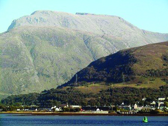
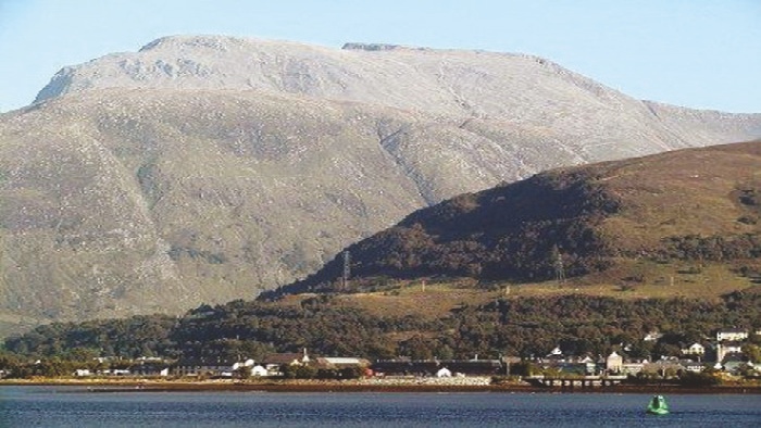
Ben Nevis on a good day.
(It definitely didn’t look like this when we saw it!)
The path up Ben Nevis is 5 miles long, including almost a mile of elevation. This means an average climb of slightly more than 1 in 6. That’s an average gradient – some bits were much steeper – and over the course of 5 miles that really takes its toll.
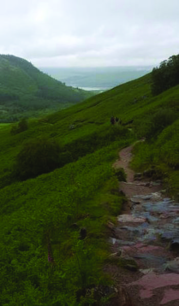
The first part of the climb was largely as expected: A decent path, some bits that were more rocky, and a fairly regular ascent. We took little breathers every so often to let our legs recover, and to let other hikers past us. In fact, over the course of the climb, we let rather a lot of hikers past us!
Dad had planned out the route, and knew that at about half-way there was a lake called the Lochan near the path. So we were keeping an eye out for that, as it would tell us that we had completed the lower half of the climb. Unfortunately, the mist had descended by the time we reached there, so there was no sign of it. I had to use my location setting on my phone’s map in order to see where we were.
After passing the Lochan – or, at least, where it would have been if we could have seen it – the path eases slightly, and there is the blessed relief of a lovely surface and a fairly moderate incline. This is how the mountain fools you: The worst is yet to come.
At about the 3-mile mark, the path resorts to a series of zig-zags. Getting to this point is both good and bad; it means that you are 60% of the way there, but this next bit is the most demanding of the entire climb. The zig-zags are used there in order to scale some particularly steep sections, and some of these are really tough. One very small up-side, though, is that at each turning you can tick another one off.
One of these sections, between turns 3 and 4, was absolutely brutal. A great many boulders needed clambering over, it was particularly steep, the ground was wet and slippery, and we were completely knackered. At the end of that section, Dad had had enough. If I hadn’t been there to encourage him (or to tell him off?), I think he would have stopped there and given up.
But, after yet another stop for a break and for more hydration, we soldiered on. And finally, we got to the end of the zig-zags. That was a great feeling, although there was still plenty to do. I think Dad had a rather idealised view of the remainder of the trek. There was still half a mile to go, but he seemed to think it was just about 500 yards. He knew we had to pass a few cairns, marking the path, before we got to the top, but the cairns just kept on coming.

This was our last view of Fort William, before the path turned and the mist descended.
There was an interesting point towards the top where we met snow for the first time. And it wasn’t just a small section; it was a giant sheet of snow that we had to climb, and it wasn’t easy. In fact, on the way down Dad decided to slide down on it as if it were a luge! The path was becoming less pronounced by this point, and we nearly lost it once. But, at last, we saw the silhouette of the Ben Nevis Observatory appearing through the cloud. From here, it was just a few yards to the trig point marking the summit of Great Britain.

We made it to the top!!!
Not that it was worth it for the view ……
It was quite an emotional experience for me, standing atop the platform at the peak. I was extremely proud of having made it to the top. It was so much harder than I thought, and the sense of accomplishment was overwhelming.
Dad had predicted that it would take about 5 hours to go up, and a similar amount of time to come down again, because of the care needed to go over all the rocks. It actually took us 6½ hours to reach the top. Some of that delay was because of the many breaks we took to recuperate; some was because we weren’t as fit as most other people who go up the Ben (we even saw some running up it!); but a lot of it was because it was much tougher than we anticipated.
It is worth pointing out that we are pretty certain that Dad was the oldest person to climb Ben Nevis that day. We saw one senior gentleman on the ascent, but he was a very moderate 72. To have achieved such a feat at the age of 75 is of immense credit to him. And apart from wanting to call it quits ¾ of the way up, he even fared better than I did!
Going down was so much easier than going up. Our legs delighted in the ability to actually go downhill, as opposed to the 6½ hours of uphill they had endured so far. Yes, there were boulders that needed care when descending, but the pace was much quicker than when coming the other way. Of course, going down does have its pitfalls. The thighs and calves suffer on the way up, but the knees bear the brunt on the way down. And mine suffered quite a lot. It became quite difficult going down at times, but, eventually, we got to the bottom and back to our hotel.
So that was my adventure to the top of Great Britain. I am extremely pleased to have done it, but I don’t think I’ll be doing it again anytime soon. My body needs a rest, and a big dram of Scotch!

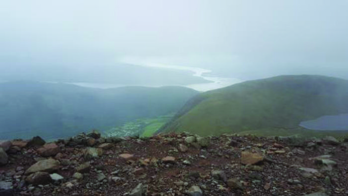
A view of Loch Linnhe, Loch Eil and even the Lochan,
which all magically appeared on the way down when the mist cleared briefly.


